Handi Gundi Betta trek
Place : Handi gundi Betta (Near Ramnagara)
Distance from Bangalore : Around 60-70 km
Trip type : Day trip/Half day trip
Day of travel : 23rd August
Trekking length/Duration : Approx 4 km (to and fro). 2-3 hour
Difficulty level - Moderate
 |
| The conquerors |
"Alone in mountain, lost your trail, standing on slanting hill which has steep valley down..."
How do you feel in above situation? if you feel thrilled and excited then Handi Gundi Betta is best spot in Covid situation. 😊
This trip was much more thrilling than we expected, we had challenges everywhere not only on the trek path. This was our 3rd trek within Bangalore since lockdown. We started enjoying and getting comfortable in this kind of outing until the situation become normal and we can have vacation again.
So the story begins -
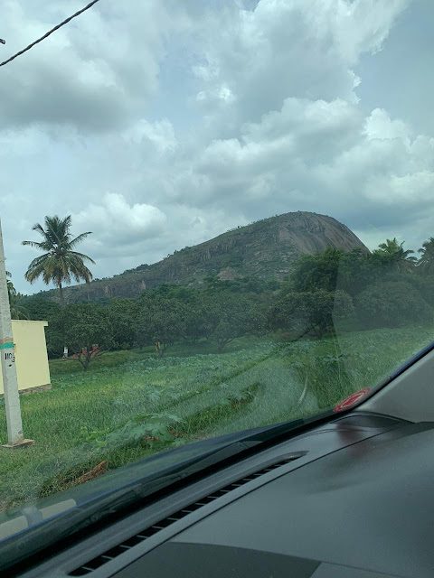
We set the google map location "Handi Gundi betta trek starting point" and started from home around 12 Noon. It was around 2 PM when we hit one railway crossing; just 2 km before the marked location, which was closed due to maintenance till 5PM. I tried to check with other people if there was another route to that place. They told us to find next crossing and then take that road. Google maps was telling us to take U-turn until we hit the next crossing. Thankfully, it finally re-routed after the crossing. The almost drove through narrow village road and then mud road (not very car friendly). We somehow managed to crossed all hurdles and reached to the Trek Start location. Now started the challenge. Unlike few other treks, the starting point (hope we got it right) neither had a notice-board nor guidance on where to start the trek from. We could see the hill but the question was where to start?
 |
| Handi Gundi betta form the car!! |
 |
| This is how we reached to the base point. |
We were confused if we had reached to the right point? Whether we will be able to come back to the same point while trekking down? Will we be tress-passing someone's property? We saved the location of our parked car just in case we got lost.
We crossed few farm fields and reached to one sign board which was in Kannada declaring it was Handi Gundi Betta. We assumed it says trekking starts here and started trekking.
 |
| Here is the board!! |
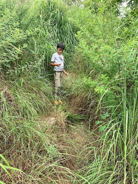
We started the trek but we had constant doubt in mind if we were on the right path or not. However my son,Tatva, was too excited for this trek and said he could see the trails. In Hindi we say - Har bachche mai bhagwan hota hai(Each child has god within itself) , so we let the god show us the path. He became our Trek Guide.😉
 |
| Is this the right trail?? |
 |
| Take a break... |
The view while trekking was very scenic. We could see many small hills and valleys around, it could remind you view of any famous hill station (just that it was hot and humid here, thankfully it was cloudy day though)
We found so many dead ends, long grass and shrubs covering the trek path. We thought god (Tatva!) was not working as good guide and we humans had to take charge. LOL!!
We were on our own, we had to use our trekking instinct and go ahead because we couldn't see the hill top while climbing up and we could not see any markings. Amber was also worried about losing the car parking location. We were enjoying getting lost in the mountain and finding our own path until we reached to point where we realized that we were on the sloped edge (like a mountain pass) and there was deep valley down. While we were trying to figure out the path, Tatva refused to hold our hand and said he wanted to trek on his own without any support. I asked my husband to go back again, but he was very far ahead and said "I can't come back, let's continue."
I begged my son to take my help, and with great difficulty we crossed that stretch and reached the flat surface. What we assumed would be hill top was just halfway mark as the hilltop was still staring at us from above. At this point we decided to find the trekking path and stick to it.
 |
| This looks like right path. |
After searching for sometime we finally found the marking on the rocks. which said - "Rest point 😀(yes, the marking was with smily)". We were so happy and relaxed to see that. The sad point was we were only half way through but the good point was we found the trekking path. We tried to stick to the trek path, but we still got lost,thanks to large bushes and shrubs which made the Trek Path look like deadends. 😭
After trekking for 15 more minutes, my son got too tired and said he wanted to go back home. We decided to take another break, we ate our packed food and drank gluconD, recharged/cheered-up my son and started trekking again.
 |
| Break time!! |
Last stretch was very steep and full of long and itchy grass but at-least it was visible. After one and half hours, finally we reached the hill top. Woo hooo!!I was so thrilled after reaching to the top that I actually felt like I conquered some Himalayan Peak. This was proper hill top without any structure, we had full 360 degree panoramic view. We could see Ramanagara and Bengaluru, both the cities from the top.
 |
| Finally the top!! |
 |
| 360 view |
Getting down was easier as compared to climbing up. We did not take any breaks. It was getting dark and cloudy. We trekked down in straight 45 min. The last stretch of trekking down was pretty steep and one needs to be really careful while coming down. In this trek we were literally alone, there were no humans, no monkeys, no dogs, no goats, except Chameleons, Butterflies, Honey bees. In other treks
at-least we had company of Monkeys or dogs if not humans. 😉
Points to Note -
- Carry as much water as you can.
- Wear proper trekking/sports shoes, caps, goggles. Take breaks and remain hydrated.
- Trail marking is not proper, there are high chances of getting lost.
- Pin and save your parking location.
- Don't litter. The place was really clean; let it be clean.


Easy to follow, thanks for sharing!
ReplyDeleteThankyou. :)
Delete